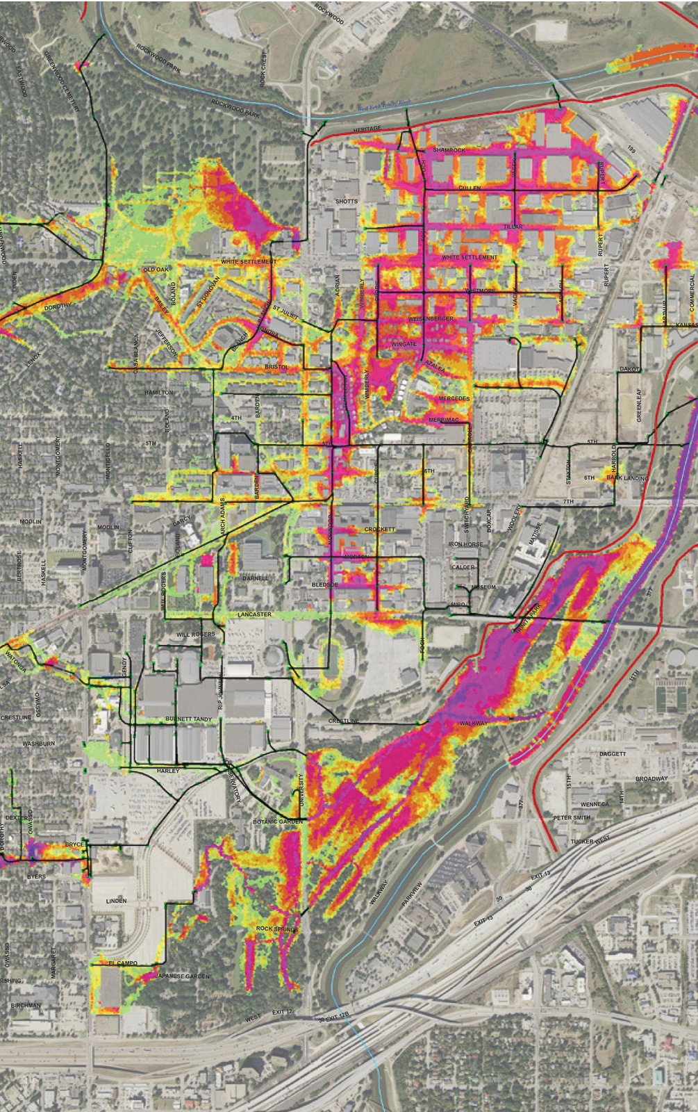
The West 7th / University area has a long history of flooding due to a severely undersized storm drain system that cannot contain the expected stormwater runoff. Our hydrology and hydraulics team developed a two-dimensional (2D) model of the entire 1,950-acre watershed. The sump intersections along Norwood Drive were shown to be inundated by a wide range of 1- to 100-year storm events, with levels reaching four feet.
To decrease flooding depths at the intersections, a storm drain relief system was evaluated, which is included in Dunaway’s Trail Drive extension alignment, to convey stormwater to the Clear Fork Trinity River. The results of the 2D modeling suggest the Trail Drive relief line will alleviate the majority of the Norwood sump area flooding, although there will still be some ponding at the intersections along with Norwood and Currie/Lancaster.
-
Location:Fort Worth, Texas
-
Client:City of Fort Worth
-
Services:Civil Engineering