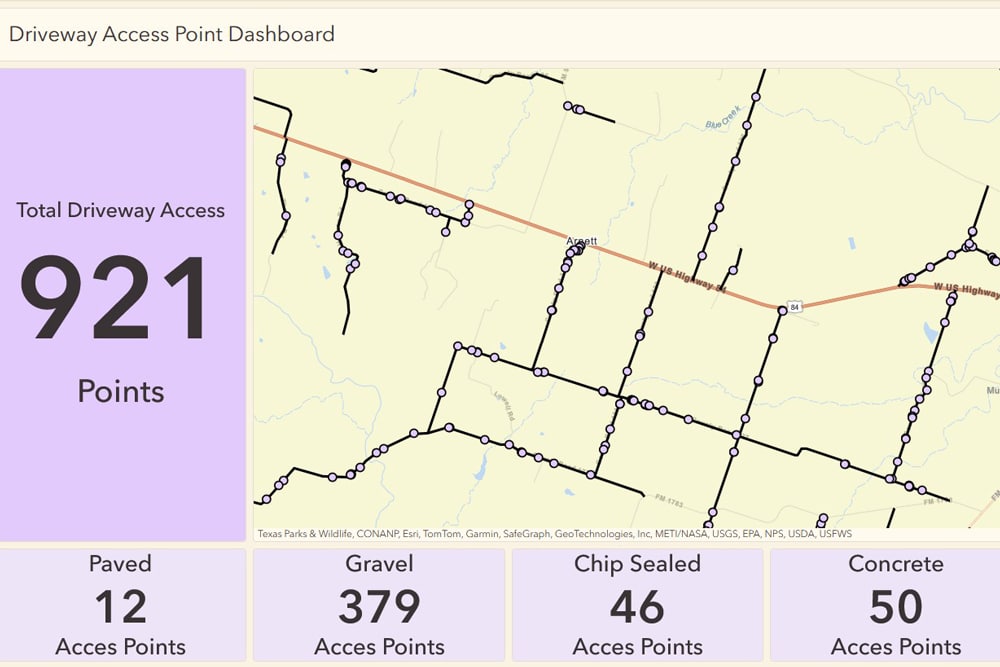
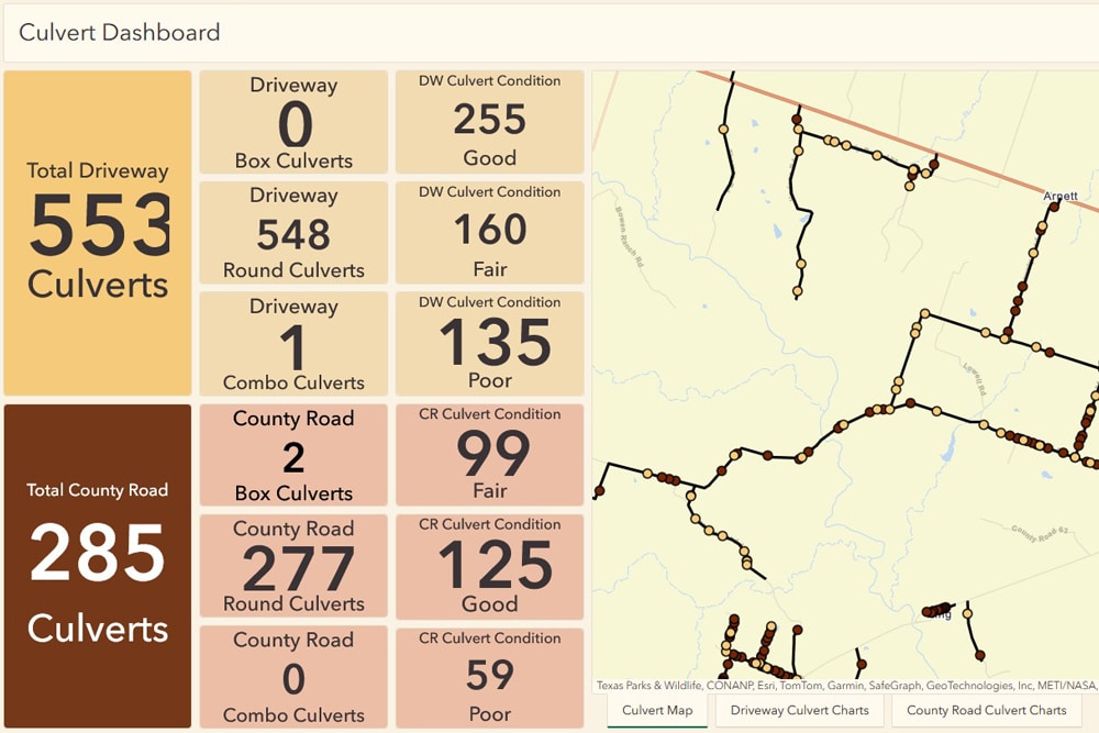
Dunaway’s GIS specialists are partnering with Coryell County Road and Bridge staff to enhance the county’s existing geospatial datasets. These datasets currently include various infrastructure elements such as roadway surface types, cattle guards, low water crossings, field entrances, and driveways. However, the roadway layer lacks key maintenance and repair data. To improve usability and accuracy, Dunaway will restructure the data into individual layers for each asset type, enabling county staff to collect and edit information more efficiently. The roadway layer will also be updated to include attributes like construction date and material type, providing a clearer visual representation of road conditions across the county.
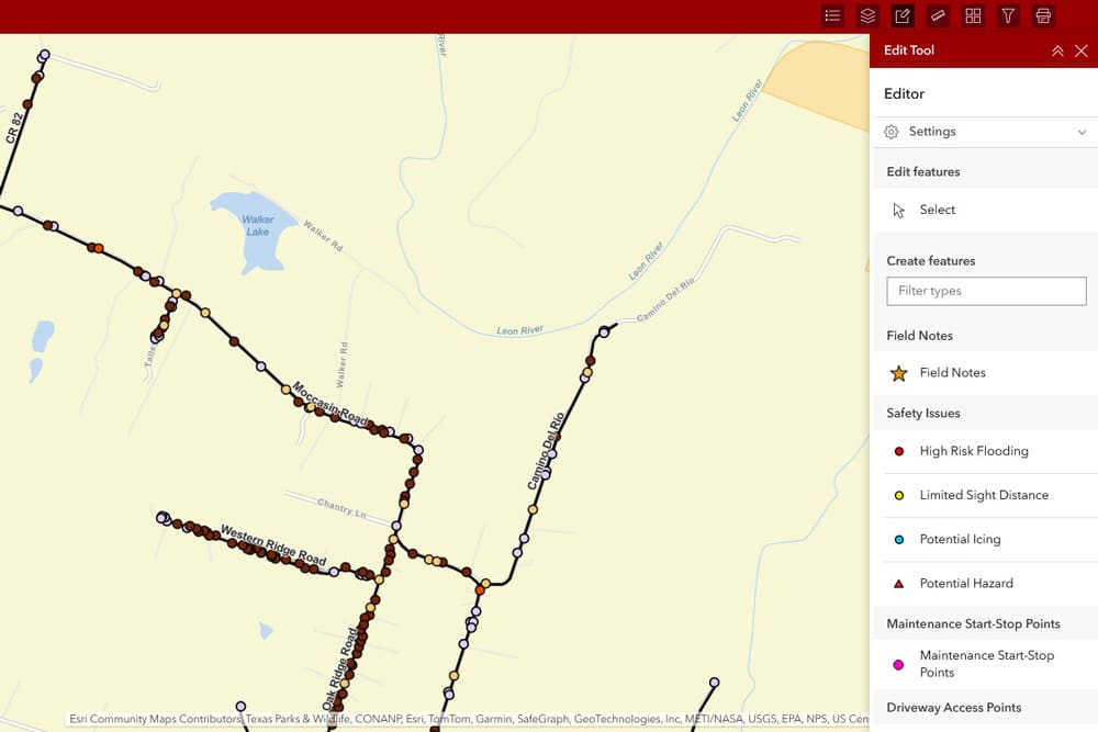
As part of the initiative, Dunaway will train Coryell County staff on data collection and editing using ArcGIS Online and the ESRI Field Maps mobile application. This hands-on training will empower the team to maintain and update GIS data in real time, supporting better decision-making and long-term asset management.

-
Location:Coryell County, Texas
-
Client:Coryell County
-
Services:GIS