Shaping Cities: The Power of Comprehensive Planning

In our Shaping Cities series, we highlight the different phases of city development, offering insights into how we provide innovative solutions and strategic guidance to cities of all sizes.
The first article in this series highlights the first critical step in a city’s evolution: comprehensive planning. This phase involves creating a roadmap for a city’s growth and development. It addresses various elements such as land use, transportation, economic development, housing, parks and recreation, and infrastructure, serving as a guide for future actions and decisions.
The Dunaway Difference
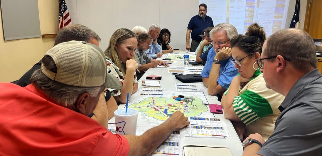
At Dunaway, our approach to comprehensive planning is rooted in understanding and executing the city’s vision. We believe in being true partners, working closely with city staff and the community – making sure that the plans we develop are practical, implementable, and aligned with the city’s long-term goals. Our intention is to serve the community by making strategic decisions that facilitate sustainable growth and development.
Rather than imposing a one-size-fits-all solution, we take the time to listen, collaborate, and tailor our approach to each city’s unique needs and vision. This approach is rooted in our core values, which include having an attitude of service. In relation to comprehensive planning, this translates to being forward-thinking problem solvers and trusted partners throughout the process.
Our comprehensive planning process is about distilling the community’s values and vision into actionable plans. We work closely with city administrators and councils to ensure that our plans are not just visionary but also grounded in reality. This approach helps cities make informed decisions about zoning, budgeting, and infrastructure development, ultimately leading to sustainable and manageable growth.
”“Our comprehensive planning process is about distilling the community’s values and vision into actionable plans,” explains Senior Planner and Associate, Stephen Cook, AICP. “We work closely with city administrators and councils to ensure that our plans are not just visionary but also grounded in reality. This approach helps cities make informed decisions about zoning, budgeting, and infrastructure development, ultimately leading to sustainable and manageable growth.”
In the first of our four-part series, we reflect on the comprehensive plans for several different cities, the unique challenges they faced, and Dunaway’s strategies for overcoming them.
City of New Fairview Planning Services – New Fairview, Texas

New Fairview Comprehensive Plan
Nestled on the western edge of Wise County, just 30 miles north of Fort Worth, the City of New Fairview was incorporated in 1973 to safeguard its rural charm from the looming suburban expansion. As the city grows into Denton County, the need for strategic planning and careful land management has become more critical than ever.
With development pressures mounting, city leaders have turned to Dunaway’s planning and GIS expertise to help facilitate thoughtful, well-managed growth. Our team is guiding New Fairview through the complexities of transitioning from vast ranchlands to a balanced mix of residential neighborhoods and commercial hubs. Through zoning and subdivision plat reviews, specialized planned development regulations, and Development Agreements in the ETJ, we are shaping a framework for sustainable expansion.
After successfully assisting in the city’s comprehensive planning efforts, Dunaway intends to assist in rewriting its zoning and subdivision ordinances – laying the foundation for a future that honors New Fairview’s heritage while embracing its evolution.
City of New Fairview Interactive Planning Database
In 2019, Dunaway created a collection of interactive maps for the City of New Fairview to share with the City Council and other community members. The web application provided a central location for finding information of interest, including zoning, road surface types, existing and proposed subdivisions, and more. To include the most updated base data, Dunaway added available live layer feeds from trusted sources, including Wise and Denton County Appraisal Districts, North Central Texas Council of Governments, Texas Railroad Commission, FEMA, and more.
Dunaway has a strong partnership with Esri, the leading provider of geospatial software, and utilizes its ArcGIS Online platform for a diverse set of projects across all Lines of Business (LOB). Within the Planning + Landscape Architecture (P+LA) LOB, ArcGIS Online facilitates data collection and analysis and can be used as a shared portal and database for information. Given the ability to share outside the organization, this platform enables collaboration between Dunaway, our clients, and other consultant team members. This robust application can also further community engagement by providing 24-hour access for the public to explore existing conditions and development proposals. In addition to the online mapping capabilities, the application can link to community surveys and other reports or websites.
Caddo Mills Future Land Use Plan – Caddo Mills, Texas

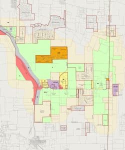
Caddo Mills Future Land Use Plan
Lying on the western side of Hunt County, Caddo Mills has a strong railroad history as part of the Missouri, Kansas, and Texas (KATY) Railroad system importing and exporting goods, and people into and out of Texas. Caddo Mills views itself as a bedroom community with a high demand for housing growth. Excellent schools make it a prime community in which to relocate. A city-owned airport facility and frontage along Interstate 30 provide opportunities for commercial and employment-centered growth to fulfill much of the community’s wants and needs into the future.
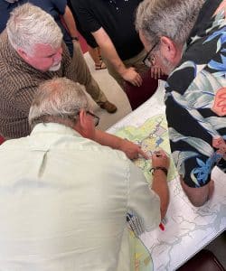
The Comprehensive Plan process was a collaborative effort. The steering committee provided direct input into the future land use locations and was instrumental in the creation of a vision for the community which is focused on preserving the look and feel of the existing neighborhoods while sustainably managing new growth.
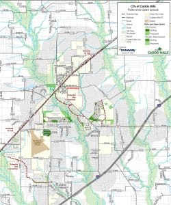
Caddo Mills’ Comprehensive Plan focused on growing the I-30 Corridor and preserving the floodplain for a park system and trails. As a result, Dunaway was able to secure a park master plan and a construction plan for a park following the comprehensive plan.
Kennedale Comprehensive Plan Update – Kennedale, Texas
Dunaway partnered with the City of Kennedale to update its Comprehensive Plan, paving the way for a more strategic and sustainable approach to development. Recognizing the need to align with the existing housing market, our team established clear goals to encourage smart residential density while maintaining thoughtful design.
Through a collaborative effort – including publicly streamed steering committee meetings – we worked closely with the community to reorganize the city’s Unified Development Code (UDC) in a way that reflects Kennedale’s values and future vision. Portions of the city’s UDC, written by another firm, proved impractical for real-world implementation. Now, Dunaway is adapting the UDC, ensuring it is functional and forward-thinking to support Kennedale’s long-term growth.
Bridgeport Comprehensive Plan – Bridgeport, Texas

City of Bridgeport Comprehensive Plan
Dunaway collaborated with the City of Bridgeport on a comprehensive city plan to foster sustainable growth, preserve historical assets, strengthen infrastructure, and drive economic diversification. Developed with input from a steering committee, city staff, online surveys, and public meetings, the plan serves as a blueprint for a resilient and prosperous future.
Key priorities included managing housing growth through partnerships to ensure affordable, sustainable options for all demographics. It prioritizes preserving Bridgeport’s historic downtown with incentives for restoration, local business support, and pedestrian-friendly spaces. Investments in infrastructure, like roads and stormwater systems, aim to enhance resilience and sustainability by implementing modern technologies and solutions.
Through collaboration, innovation, and strategic planning, the city aims to create a thriving, sustainable, and inclusive community for current and future generations. Dunaway’s partnership with Bridgeport has included a new comprehensive plan, a downtown park design, ongoing day-to-day engineering services, and an update to the city’s zoning and subdivision ordinances. The comprehensive plan has influenced the city’s infrastructure planning and resource allocation.
Ready to make your vision come to life?
Dunaway’s approach to comprehensive planning is a collaborative and systematic process designed to meet the needs and expectations of the city and its residents. Using this process, comprehensive plans are active documents invaluable to the decision-making process by elected and appointed officials and city administrative staff. Dunaway’s multidisciplinary approach streamlines consultant management and offers a single point of accountability, blending aesthetics with practical solutions for long-term value that improves lives in the communities we serve.

